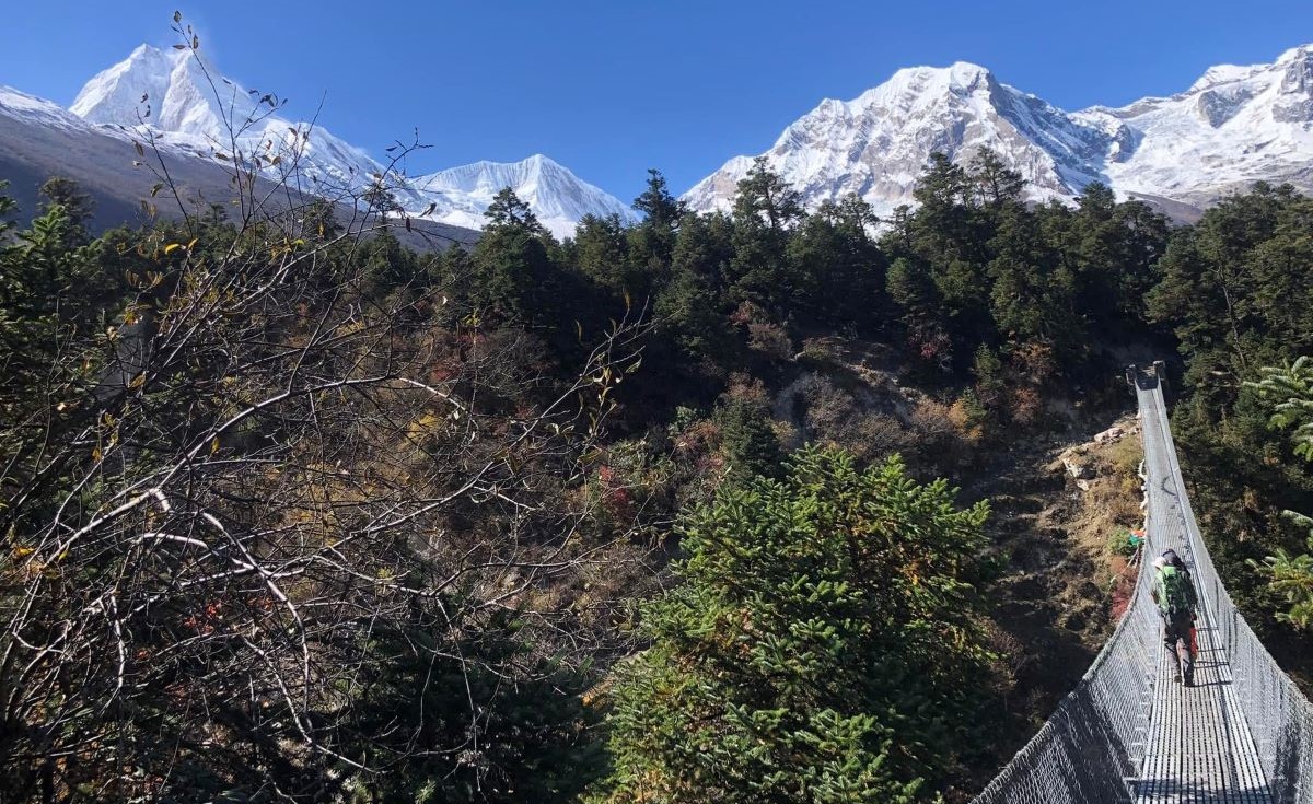
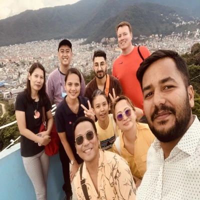
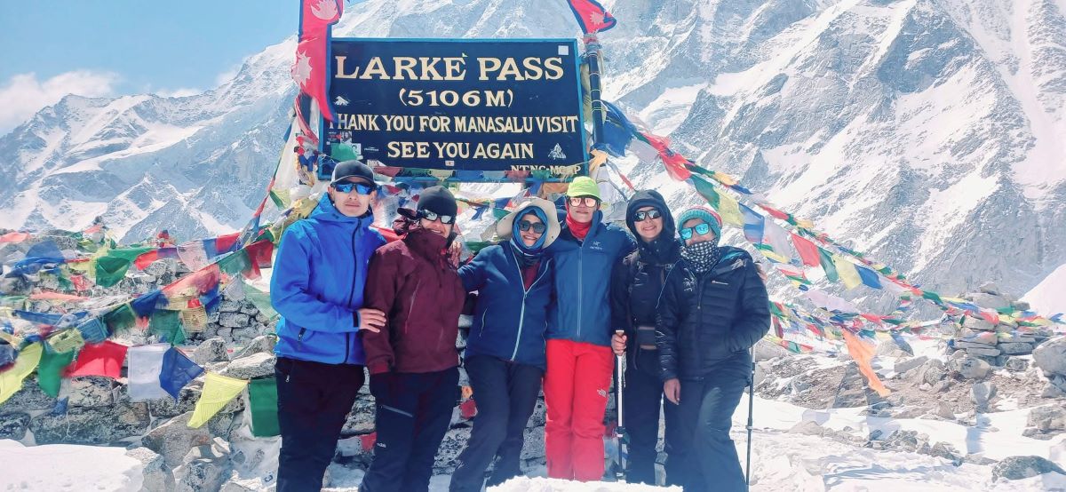
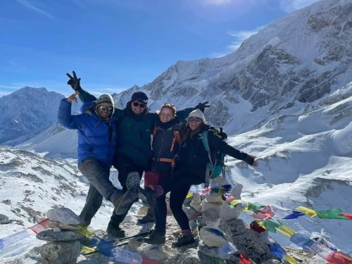
Our Team at Larke La Pass 5106m during Manaslu Circuit Trekking
One of the most difficult and rewarding aspects of the Manaslu Circuit Trek is saved for the very end. After days of walking through river valleys, forests, traditional mountain villages, and the increasingly rugged landscape around Sama Gaun and Samdo, the trail finally leaves the inhabited valleys behind and heads toward the iconic Larkya La Pass, which has been waiting in the distance.
Larkya La, at 5,106 meters, is the highest point on the Manaslu Circuit and the point in the trek where altitude becomes unavoidable.
The morning can be extremely cold, the air is thinner, and walking steadily uphill requires more effort than walking downhill. From Dharamsala (4,460 m), the trail climbs toward the pass in a long day that demands both physical preparation and proper acclimatization.
However, Larkya La Pass is more than just an elevated location. The entire Manaslu journey seems to naturally come to a close with the crossing. A bleak alpine landscape of rocky slopes, snow, glaciers, and vast Himalayan horizons has replaced the verdant valleys and thick forests of the lower route. The scenery and atmosphere noticeably change as the trail starts to descend toward Bimthang on the opposite side of the pass.
Under normal circumstances, crossing Larkya La is not a technical mountaineering climb, but it is undoubtedly an accomplishment. The combination of altitude, distance, cold, weather, and the cumulative weariness of the journey is what makes it difficult. A realistic approach to mountain conditions, sensible pacing, appropriate clothing, an early start, and good acclimatization are all important.
For many trekkers, crossing Larkya La Pass becomes the moment they remember most from the Manaslu Circuit. It is the highest point of the journey that defines this high-altitude trek in Nepal, but also the point where the many days of gradual walking, acclimatization, and preparation finally come together.
This guide covers what you actually need to know before the Larkya La Pass Trek, from its altitude and location to the route, difficulty, weather, acclimatization, best seasons, preparation, safety, views, and what the crossing day is really like.
Larkya La Pass is located in the high Himalayas of north-central Nepal, within the Manaslu Conservation Area, and serves as the high crossing point between the upper Manaslu region and the Bimthang side of the circuit.
It is reached after trekking through Sama Gaun, Samdo, and Dharamsala, making it one of the final major landmarks before the route descends toward Bimthang.
The pass is approximately 5,106 meters (16,752 feet) above sea level. At this elevation, the contrast with the lower sections of the Manaslu Circuit Trek is striking.
The journey around Machha Khola begins at 870 meters, but by the time you reach Larkya La, you've climbed more than 4,000 meters.
Furthermore, the approach is also part of what makes the location special. From Dharamsala, the trail enters a much more exposed high-altitude landscape, with fewer signs of permanent settlement and increasingly rugged mountain scenery. When hikers start the pass crossing early in the morning, the surroundings can seem vast and far away.
Geographically, Larkya La is more than simply the highest point marked on the itinerary. It acts as a natural transition between two very different sections of the Manaslu Circuit. The effects of the high altitude gradually lessen as you cross the pass and start to descend toward Bimthang.
Understanding Larkya La Pass's elevation and location on the route is crucial for anyone intending to cross it, as the pass is not a standalone attraction. It comes after a few days of altitude gain, which is why getting acclimated and ready before arriving in Dharamsala is crucial.
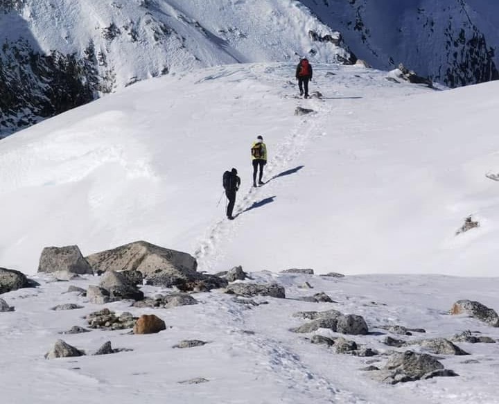
Heading towards Larke Pass 5106 During Month of December
Larkya La Pass Elevation and Key Facts
At approximately 5,106 meters (16,752 feet), Larkya La is the highest point of the Manaslu Trek and one of the major high-altitude passes in the world. The crossing is difficult because of the elevation, especially since the route takes several days to reach this height rather than a quick climb.
Key Facts
Details
Elevation
5,106 m (16,752 ft)
Highest Point
Highest point of the Manaslu Circuit
Crossing Starts From
Dharamsala / Larkya Phedi, 4,460 m
Main Destination After Crossing
Bimthang, around 3,890 m
Type Of Route
High-altitude trekking pass
Technical Climbing Required
No, under normal conditions
Main Challenges
Altitude, cold, long trekking hours, and trail conditions
Typical Crossing
Early morning start from Dharamsala
Trekking materials may also give Larkya La slightly different elevations, typically 5,100 meters or slightly higher. Rather than a totally different pass, this is frequently caused by variations in mapping and measurement.
For hikers, the fact that a portion of the crossing is above 5,000 meters is crucial. It is crucial to properly acclimate before traveling to Dharamsala because the lower oxygen levels, frigid temperatures, and physical strain become much more apparent at this elevation.
History, Culture and People Around Larkya La Pass 5106m
Larkya La Pass is part of a much older landscape than the modern Manaslu trekking route. For generations, people living in the upper Budhi Gandaki valley depended on the mountain trails for movement, trade, livestock, and connections with neighboring Himalayan communities.
The route followed by today's Manaslu Region is described by the Nepal Tourism Board as an ancient trail and part of the traditional salt-trade route along the Budhi Gandaki River.
A Route Shaped by Trade
The high valleys around Samdo, Samagaun, and Larkya La were never completely isolated from the world beyond the mountains. Their proximity to Tibet meant that trade and movement across the Himalayan border played an important role in local life.
Salt from Tibet was historically exchanged with goods from the lower valleys, while mountain communities also moved livestock and other supplies between settlements according to the seasons.
The difficult terrain meant that these journeys depended on foot trails and pack animals rather than roads. A pass such as Larkya La was therefore not simply a scenic mountain crossing. It formed part of the wider network of trails that allowed people living on either side of the high Himalayas to maintain economic and social connections.
The Nepal Tourism Board specifically notes that the Manaslu trekking route follows the classic salt-trade route along the Budhi Gandaki, giving the modern trek a historical connection that goes well beyond tourism.
Tibetan Influence in the Manaslu Region
The closer you get to Larkya La, the stronger the Tibetan cultural influence becomes. Tibetan Buddhist customs have historically influenced the upper Manaslu settlements, as evidenced by the monasteries, prayer flags, mani walls, religious rituals, architecture, and village life. According to the Nepal Tourism Board, Buddhism plays a significant role in the Manaslu region, which shares much of its history and culture with neighboring Tibet.
This is particularly noticeable around Sama Gaun and Samdo, where the architecture and religious landscape feel distinctly different from the lower Budhi Gandaki valley. The high-altitude environment also shaped how communities lived. Farming possibilities were limited, so people traditionally relied on a combination of livestock, small-scale agriculture, trade, and seasonal movement.
The result is a culture closely adapted to the mountains rather than simply placed within them. Houses, monasteries, fields, grazing areas, and trails all reflect the practical realities of living at high altitude.
Who Lives Around Larkya La?
There is no permanent settlement directly on the pass itself. The communities encountered before and after the crossing belong to the wider Himalayan population of the Manaslu region. The upper valleys have strong Tibetan cultural and linguistic influences, while the wider Manaslu Conservation Area is home to several ethnic communities and distinct local traditions.
One of the fascinating features of the Larkya La Pass trek is this cultural shift. As you ascend from the lower Budhi Gandaki, the villages progressively become more Tibetan. The terrain and cultural milieu start to shift once more after traversing the pass and descending toward Bimthang and the Marsyangdi side.
From Ancient Trail to Trekking Route
Modern trekkers experience Larkya La very differently from the people who once depended on these trails. Today, the crossing is one of the highlights of the Manaslu Circuit Trek, while historically these mountain paths were part of everyday survival and regional exchange.
The Manaslu region was opened to foreign trekkers only in 1995, and it has retained a more remote character partly because trekking is regulated through the restricted-area system.
That history is worth remembering when crossing Larkya La. The trail is not simply a route created for adventure tourism. It is part of a much older Himalayan landscape where the mountains were integral to village life, trade, religion, migration, and livestock.
For trekkers, that adds another layer to the experience. Reaching 5,106 meters is just one aspect of crossing Larkya La; another is passing through an area where the mountains have influenced how people have lived, traded, worshiped, and interacted with one another for many generations.
Before Crossing Larke La Pass 5106m
How Long Does It Take to Cross Larkya La Pass?
The Larkya La Pass Crossing is generally treated as a full-day trek. Most itineraries such as our standard Manaslu Circuit Trek Package allow roughly 7 to 10 hours for the journey from Dharamsala to Bimthang, including the ascent to the pass, short breaks, time at the top, and the long descent.
You shouldn't attempt to forecast the precise timing down to the minute. The length of the day can vary depending on your pace, altitude experience, weather, trail conditions, snow conditions, group size, and how your body reacts to elevation.
A typical day looks roughly like this:
Sections
Approximate Time
Dharamsala to Larkya La Pass
4-5 Hours
Time at the Larkya La Pass
15-30 Minutes
Larkya La To Bhimthang
3-4+ Hours
Total Trekking Time
Around 7-10 Hours
Usually, the climb to the pass requires the greatest focus. You can't expect to walk at the same pace you did in the lower Manaslu valleys at a height of over 4,500 meters. Even when the trail doesn't appear to be very steep, the last climb can feel especially slow.
Thus, it's crucial to start early. Morning weather is frequently better for a high-pass crossing, and it allows you enough daylight to finish the crossing without having to rush the descent.
Additionally, don't evaluate the day based on how fast another hiker gets to the summit. At altitude, it's usually wiser to move at a slower but steady pace. Taking a few more breaks along the way is far more desirable than arriving at Larkya La exhausted and then facing a long descent.
If weather or trail conditions deteriorate, the timing can change considerably. This is why experienced guides leave room in the schedule and make decisions based on actual mountain conditions rather than treating a published trekking time as a guarantee.
Safety Tips for Crossing Larkya La Pass
A successful Larkya La Pass crossing depends as much on good judgment as physical fitness. The pass is above 5,000 meters, and conditions can change quickly, so it is important to treat the crossing as a serious high-altitude trekking day.
Start early. Leaving Dharamsala before sunrise gives you more daylight for the long crossing and generally means reaching the pass before afternoon weather becomes more unpredictable.
Stay with your group and guide. The trail can become difficult to follow in heavy snow, fog, or poor visibility. An experienced local guide can also judge trail conditions and decide whether it is safe to continue.
Walk slowly and consistently. At this elevation, trying to maintain your normal trekking speed can exhaust you quickly. A steady pace with short breaks is usually more effective than frequent long stops.
Don't ignore altitude symptoms. Headache, nausea, dizziness, unusual weakness, or worsening fatigue should be reported immediately. If symptoms become severe, continuing toward the pass is not worth the risk. Descent is the primary response to serious altitude-related illness.
Be prepared for changing weather. Even during the best trekking seasons, Larkya La can be extremely cold and windy. Keep your warm layers, gloves, hat, sunglasses, and waterproof protection accessible rather than buried at the bottom of your backpack.
Watch your footing on the descent. Once the excitement of reaching the pass wears off, the long downhill section toward Bimthang can be surprisingly tiring. Snow, ice, loose rocks, and wet ground can increase the chance of slipping, particularly when your legs are already fatigued.
Finally, remember that getting down safely is just as important as reaching the summit. Larkya La will never leave. It makes sense to turn around or postpone the attempt if the Larkya La weather or health conditions make the crossing unsafe.
Final Thoughts
Larkya La Pass is difficult for a straightforward reason: practically all of the crossing takes place at a high altitude. You begin early from Dharamsala, ascend above 5,000 meters, endure several hours in exposed and frigid conditions, and then face a lengthy descent to Bimthang.
However, it is also the most rewarding part of the whole 13-day Manaslu Circuit Trek. The days spent acclimating around Sama Gaun and Samdo, the gradual transition from verdant valleys to the high alpine landscape, and ultimately the ascent toward the pass all contribute to this single crossing.
You don't need technical mountaineering skills to cross Larkya La under normal conditions. You do, however, require adequate acclimatization, a reasonable level of fitness, appropriate gear, an early start, and sufficient patience to move at a pace that your body can handle.
Weather and trail conditions will always be unpredictable at 5,106 metres, so flexibility matters too. If conditions are poor or you are experiencing serious altitude symptoms, reaching the pass should never take priority over your safety.
For most trekkers, the moment at the top is brief. The real reward comes from the entire day: leaving Dharamsala in the dark, slowly gaining altitude, reaching the highest point of the circuit, and then watching the landscape change again as you descend toward Bimthang.
Because of this, crossing the Larkya La Pass is more than just reaching the top of the Manaslu Circuit. On this day, the entire journey seems to have reached its destination.
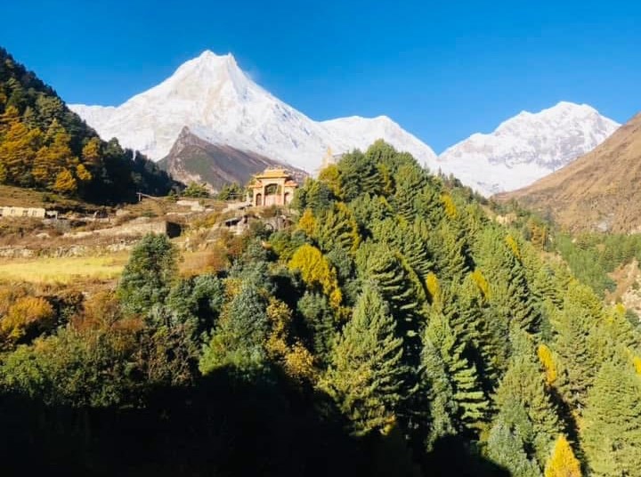
Eight Highest Mountain in the World Mount Manaslu 8163m During Manaslu Trek
Frequently Asked Questions
1: How high is Larkya La Pass? Larkya La Pass is approximately 5,106 metres (16,752 feet) above sea level. It is the highest point of the Manaslu Circuit and the main high-altitude crossing between the Dharamsala and Bimthang sides of the route.
2: Is Larkya La Pass difficult to cross? Rather than technical climbing, it is regarded as difficult due to the 5,106-meter altitude and the lengthy crossing day. Proper acclimatization, regular hiking preparation, a steady pace, and suitable equipment make the crossing much more manageable.
3: How long does it take to cross Larkya La Pass? The journey from Dharamsala to Larkya La and onward to Bimthang commonly takes around 7–10 hours, although conditions and individual pace can make the day shorter or longer. It is best to allow plenty of daylight rather than planning around a strict arrival time.
4: Do I need mountaineering experience for Larkya La? No. Larkya La is a trekking pass rather than a technical climbing peak under normal conditions. However, you should be comfortable with long hiking days and prepared for the effects of walking above 5,000 meters.
5: Can beginners cross Larkya La Pass? Yes, beginners can cross it if they are reasonably fit, properly acclimatized, and prepared for a demanding high-altitude day. First-time high-altitude trekkers should avoid rushing the itinerary and should follow the guidance of an experienced guide.
6: What is the best month for crossing Larkya La? October and April are among the most popular periods because they generally offer good visibility and favorable trekking conditions. Spring (March-May) and Autumn (September-November) are usually preferable, although mountain weather can change at any time.
7: Is there snow on Larkya La Pass? Snow is possible, especially in the winter and following a new snowfall. Seasonal and annual variations in the amount are significant. Your guide should evaluate the conditions both before and during the crossing because snow and ice can make the route slower and more slick.
8: Where do you stay before crossing Larkya La? Trekkers normally spend the night at Dharamsala (4,460 m), also known as Larkya Phedi. Because the crossing is long and usually begins early, accommodation here is basic, and availability can be limited during busy trekking seasons.
9: Can altitude sickness affect you at Larkya La? Yes. At 5,106 meters, altitude sickness remains a serious consideration even for experienced trekkers. The best approach is gradual acclimatization, including the planned stops around Sama Gaun and Samdo, while monitoring symptoms throughout the trek.
10: Is Larkya La Pass open all year? Not necessarily. Heavy winter snowfall and poor mountain conditions can make the pass difficult or temporarily unsafe to cross. Spring and autumn are generally more suitable, but the actual condition of the pass depends on current weather and snow conditions.
11: What should I carry for the Larkya La crossing? Carry warm and windproof layers, gloves, a warm hat, sunglasses, sunscreen, sturdy trekking boots, trekking poles, a headlamp, water, snacks, and personal medication. Depending on snow and ice conditions, your guide may also recommend additional traction equipment.
12: Is Larkya La Pass worth the effort? For most trekkers, yes. The crossing is demanding, but it is also the highest and one of the most dramatic parts of the Manaslu Circuit Trek. One of the route's most memorable experiences is the long descent, the high-altitude scenery, and the feeling of isolation.
Born and raised in the Mountainous village of Gorkha Nepal. Mr. Pandey is a successful tour leader and a very active social worker contributing a lot to the welfare of society. Mr, Pandey belongs to a very humble background and has started his career as a junior staff in a much-reputed company in Nepal. Mr. Pandey's family background is engaged in the tourism sector for an extended period. After spending many years in research and the drawbacks of tourism development.
Due to his great passion and enthusiasm for the trekking and tourism sector, he started his tour career with many expert teams. He intends to bring revolution to the tourism sector by offering luxurious services and accommodations to travelers at a minimum price. With the Motto of Travellers, satisfaction is my passion. He has been helping many travelers with traveling.

 based on 228 reviews


.webp)