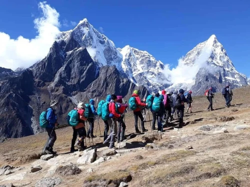
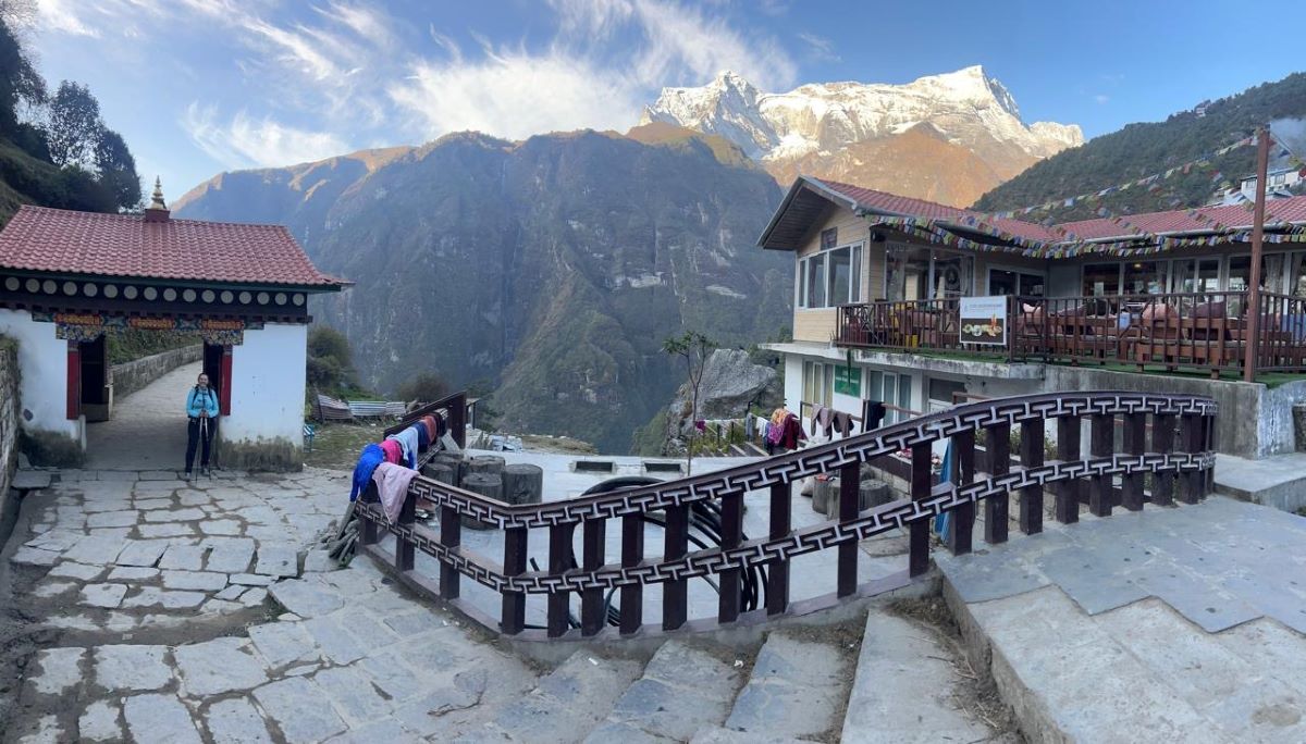
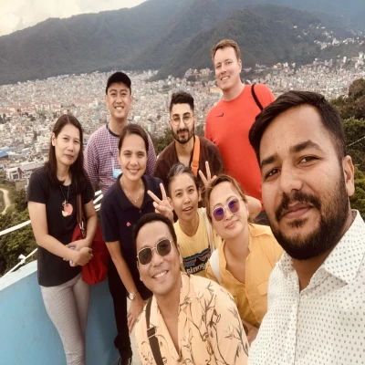
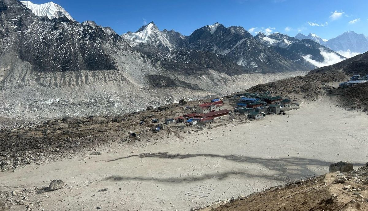
Local Mountain Lodges with Himalayan View During Gokyo Lake Trekking
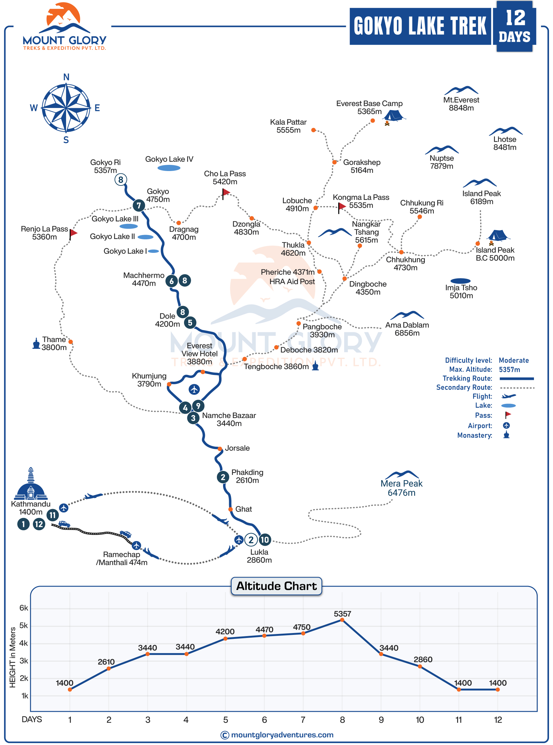
A traditional Everest region trek, the Gokyo Lakes Trek takes hikers to a series of immaculate turquoise glacial lakes, high alpine valleys, and expansive vistas. Additionally, you have an alternative to the crowded Everest Base Camp Trail with the Gokyo Lake Trek Map route.
Most importantly, for a quieter trail like the Gokyo, you will need a trekking map to understand the route's structure, especially in a region where trails split towards Everest Base Camp, Gokyo Valley, and high passes like Renjo La.
With its clear depictions of distances, elevation gain and loss, and anticipated walking hours between villages like Namche Bazaar, Dole, Machhermo, and Gokyo, the Gokyo Lake Trek map assists hikers in breaking down each trekking day.
Trekkers can lower their risk of Acute Mountain Sickness (AMS) by planning appropriate acclimatisation by using the map to identify important altitude milestones and rest areas.
A detailed Gokyo Lake Trek map shows hikers how the terrain changes from forested river valleys to alpine landscapes, glacial moraines, and high-altitude lakes.
The Gokyo map helps hikers understand what lies ahead on each section of the trail by highlighting significant natural features like the Ngozumpa Glacier, the Gokyo Lakes system, and viewpoints like Gokyo Ri.
Trail intersections, ridge crossings, suspension bridges, and valley contours are all shown on the map for navigation, which is important in places with little signage.
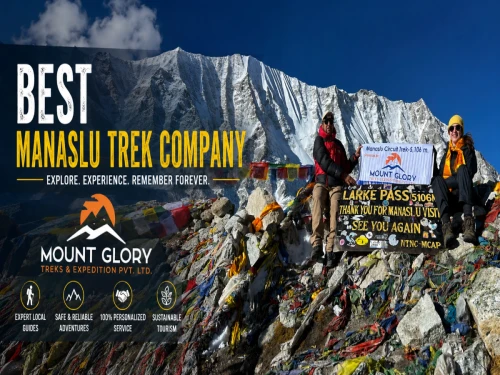
For your convenience, Mount Glory Treks has provided you with this comprehensive Gokyo Lake Trek Map. When used in conjunction with our standard Gokyo Lake Trek Package, this map gives you a clear mental picture of the route, making the trek more fulfilling and better prepared from beginning to end.
Overview of the Standard Gokyo Lake Trek Map Route
The Gokyo Trek begins with a flight from Kathmandu to Lukla, the main trailhead, in accordance with the standard Everest region route.
Following the Dudh Koshi River and traversing several suspension bridges that are clearly marked on the trek map, the trail continues from Lukla through the tranquil village of Phakding and the stunning Sherpa hub Namche Bazaar.
Additionally, Namche Bazaar is identified on the map as a crucial acclimatization point and a significant intersection where the route diverges from the well-travelled EBC trail that leads to the Gokyo Valley.
In contrast to the EBC route, the map shows the more sedate upper-valley route from Namche to Dole and Machhermo, emphasizing gradual elevation gain and fewer settlements.
As the trail ascends, the map depicts the approach to Gokyo village, which is located beside the third Gokyo Lake, with the Ngozumpa Glacier running along the valley.
Side routes to Gokyo Ri and nearby lake viewpoints are well-marked, making it easier for trekkers to understand optional climbs and panoramic views.
The map's return section emphasizes the Renjo La Pass crossing, displaying the Gokyo Valley's connection to the eastern Everest trails as well as steep ascent contours.
After descending from Renjo La, the map follows the route through Dzongla and Everest View Hotel before gradually looping back to Namche Bazaar.
Instead of a straightforward out-and-back walk, the map's last sections depict the return route from Namche to Lukla, completing a picturesque circuit.
Lukla, which is only reachable by a quick mountain flight from Kathmandu, is prominently displayed on the trekking map as the primary entrance to the Everest region.
In order to help hikers understand where motor access ends and trekking begins, the map graphically connects Kathmandu to Lukla by air before switching to foot trails. The map shows the first descent and slow valley walk along the Dudh Koshi River from Lukla, which establishes the mood for the first few days of the trek.
Lukla to Namche Bazaar
This portion of the map depicts several suspension bridge crossings over the Dudh Koshi, following river valleys and forested trails. Before the more difficult ascent to Namche, major settlements like Phakding and Monjo are designated as natural stopping places. The map's contour spacing emphasizes the considerable altitude gain during the last climb up to Namche Bazaar.
Namche Bazaar to Dole and Machhermo
The trail indicated on the map departs from the crowded Everest Base Camp route and enters the more tranquil Gokyo Valley, which has more open space and fewer lodges. A noticeable rise in altitude is indicated by steeper switchbacks and rising contour lines, particularly above Dole. The map's vegetation symbols progressively become thinner, representing the change from pine forests to alpine shrubs.
Machhermo to Gokyo
As the trail gets closer to Gokyo, the map shows a broad, glacial valley with exposed terrain and moraine fields. Situated next to the third Gokyo Lake, the route is depicted as slightly declining towards Gokyo village. In this section, the trail's closeness to the Ngozumpa Glacier becomes more noticeable.
Gokyo Lakes and Gokyo Ri Viewpoint
Instead of seeing the Gokyo Lakes as a single destination, the map helps hikers understand their layout by clearly marking the chain. Tight contour lines indicate a difficult but brief ascent of Gokyo Ri (5,357 m), which is depicted as a steep ridge ascent above the lakes. Viewpoint symbols draw attention to the location's expansive views of Makalu, Lhotse, Cho Oyu, and Everest.
Ngozumpa Glacier
Stretching alongside the Gokyo Valley, the map shows the Ngozumpa Glacier as the biggest glacier system in Nepal. Safer navigation routes are indicated by trekking routes that avoid the glacier edge rather than cross it.
Renjo La Pass (5,360 m)
Renjo La is identified as a high-altitude crossing, and its steep ascent from the Gokyo side is depicted by dense contour lines. The pass's direct connection to Dzongla on the map highlights its function as a connecting route rather than a dead-end trail.
Dzongla and Everest View Points
With widening valleys at lower elevations, the descent from Renjo La to Dzongla is depicted as long and gradual. The map shows the classic Everest, Ama Dablam, and Thamserku viewpoints as it follows the route from Dzongla to the Everest View Hotel.
Way to Namche Bazar
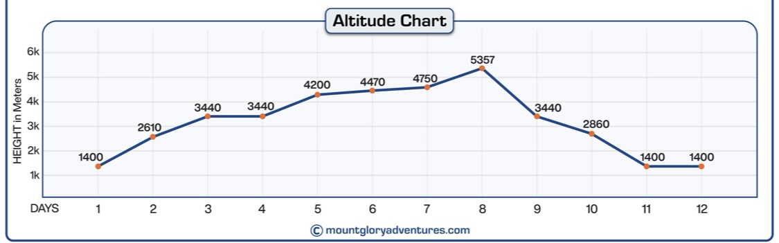
Elevation Profile and Distance Chart
The Gokyo Lakes Trek map's elevation profile and distance chart are among the most crucial resources for comprehending the trail's altitude gain and the potential difficulty of each trekking segment. Trekkers can plan their days realistically, balance walking hours, and adhere to appropriate acclimatization techniques thanks to the map's visual representation of gradual ascents, steeper climbs, and high-altitude zones.
Starting at Lukla (2,860 m), the trek gradually ascends to Namche Bazaar (3,440 m), the primary Everest region acclimatization centre. From here, the route ascends to higher and quieter villages like Dole (4,038 m) and Machhermo (4,470 m), where altitude gain is more noticeable and rest days are essential.
Gokyo village (4,790 m) is clearly marked on the map as the highest overnight stop on the typical Gokyo Lakes Trek. Next is the early morning ascent to Gokyo Ri (5,357 m), one of the Khumbu region's top vantage points.
Gokyo Lake Trek Altitude Chart
Renjo La Pass (5,360 m) and other high-altitude crossings are highlighted to help hikers prepare for long, difficult days that call for favourable weather and strong physical conditioning.
Important sites like the Everest View Hotel (3,880 m) and Dzongla (4,830 m) are also included, providing hikers with precise reference points for route orientation and altitude comparison.
All things considered, the elevation profile aids hikers in seeing the entire route, getting ready for thin air at higher altitudes, and trekking through the Gokyo Valley and nearby high passes with safety and assurance.
How to Use the Gokyo Lake Trek Map for Navigation
For effective and safe travel throughout the Everest region, the Gokyo Lakes Trek Map is a vital resource. In remote locations where mobile signals are spotty or nonexistent, hikers can use the map in conjunction with GPS devices or offline trekking apps to verify their location.
By estimating distances, elevation gain, and approximate trekking time between villages and high camps, the map aids in the planning of daily trekking stages. You can monitor your pace and energy levels and make necessary adjustments for a safer and more comfortable hike by comparing your progress on the map with the actual trail.
The map improves orientation, highlights important sites like Dole, Machhermo, Thangnak, and Gokyo Ri, and guarantees you stay on the right path even in places with numerous trail intersections or glacier crossings when used in conjunction with the expertise of an experienced local guide.
A well-planned, secure, and fulfilling trekking experience in the Gokyo region is ensured by the combination of map study, GPS equipment, and guide knowledge.
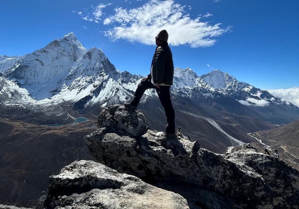
Our Guide Amy Enjoyring with Stunning Everest Himalayan Range
Conclusion
The Gokyo Lakes Trek map is essential to making the trip safer, easier, and much more pleasurable. By clearly showing daily trekking stages, elevation changes, high passes such as Renjo La, glacial sections, and the layout of the Gokyo Lakes, the map allows trekkers to plan realistically and confidently along the route.
Before you set out on the trail, you can gain a better understanding of walking distances, acclimatization points, and difficult sections by studying the map along with the itinerary.
When trekking through remote areas and high-altitude valleys, having both knowledge of maps and knowledgeable local guides makes a big difference. Along the way, professional guides handle pace, weather, and safety issues in addition to accurately interpreting the route.
Mount Glory Treks provides a well-planned itinerary, local knowledge, and complete on-trail assistance if you're planning the Everest Gokyo Trek, so you can confidently and peacefully enjoy the lakes, viewpoints, and passes.
Frequently Asked Questions
1: What is the Gokyo Lakes Trek map, and why is it important? A Gokyo Lakes Trek map is a comprehensive route guide that illustrates the Everest region's high passes, villages, lakes, glaciers, elevation gains, and trails. It enhances planning, safety, and overall confidence on the trail by assisting hikers in understanding daily distances, altitude changes, and important landmarks.
2: Does the Gokyo Lakes Trek map include Renjo La Pass? Yes, Renjo La Pass (5,360 m) is clearly marked on a proper Gokyo Lakes Trek map, along with its steep ascent, descent routes, and connection to the Everest region and the Gokyo Valley. For hikers attempting the Gokyo–Renjo La circuit, this is crucial.
3: Can beginners use a Gokyo Lakes Trek map effectively? Of course. The map is useful for tracking daily progress, identifying acclimatization stops, and anticipating challenging sections, even for novice high-altitude hikers. The Trek map becomes an important learning and safety tool when paired with a guide.
4: Does the map show Gokyo Ri and the lake viewpoints? Yes, the map highlights Gokyo Ri (5,357 m) and nearby viewpoints, including steep ridge climbs and views of Everest, Cho Oyu, Makalu, and the Ngozumpa Glacier.
5: How accurate are trekking maps for the Gokyo Lakes route? With updated trails, villages, altitude markings, and glacier routes, modern trekking maps are incredibly accurate. However, trail conditions are subject to change, which is why using maps and having knowledge of local guides is still crucial.
6: Is the Ngozumpa Glacier shown on the Gokyo Lakes Trek map? Yes, the Ngozumpa Glacier, which runs parallel to the Gokyo Valley and is Nepal's largest glacier, is clearly visible on the map. It aids hikers in visualizing the proximity of glaciers and safe routes around them.
7: Can I do the Gokyo Lakes Trek without a guide if I have a map? While a map is essential, trekking with a licensed guide is strongly advised for navigation, altitude management, weather forecasting, and emergency assistance, particularly on routes with high passes such as Renjo La.
8: Does the map include altitude and acclimatization points? Important villages like Namche Bazaar, Dole, Machhermo, and Gokyo are marked on good Gokyo Lakes Trek maps, which aid hikers in scheduling acclimatization days and lowering the chance of altitude sickness.
9: What trekking style does the Gokyo Lakes Trek map support?
Both conventional out-and-back hikes and circuit routes, including options for returning via Renjo La Pass, are supported by the map. Trekkers looking for scenic and less crowded alternatives to Everest Base Camp will find it helpful.
10: Why choose Mount Glory Treks for the Gokyo Lakes Trek? Professional local guides, meticulous route planning, well-thought-out itineraries, and knowledgeable on-trail assistance are all combined in Mount Glory Treks. Their advice guarantees a safer, easier, and more fulfilling Gokyo Lakes Trek when combined with a clear trekking map.
Born and raised in the Mountainous village of Gorkha Nepal. Mr. Pandey is a successful tour leader and a very active social worker contributing a lot to the welfare of society. Mr, Pandey belongs to a very humble background and has started his career as a junior staff in a much-reputed company in Nepal. Mr. Pandey's family background is engaged in the tourism sector for an extended period. After spending many years in research and the drawbacks of tourism development.
Due to his great passion and enthusiasm for the trekking and tourism sector, he started his tour career with many expert teams. He intends to bring revolution to the tourism sector by offering luxurious services and accommodations to travelers at a minimum price. With the Motto of Travellers, satisfaction is my passion. He has been helping many travelers with traveling.

 2 reviews